Traveling during hurricane season in Florida can be risky business.
You’re pretty much guaranteed to get a lot of rain during your trip, and that rain can disrupt plans, whether you’re in the theme parks or on a cruise ship. But once those storms grow into hurricanes, you’ll find yourself dealing with bigger problems than rain. And right now, the NHC has one such storm on watch. Note: This post is written chronologically and you can find the most up-to-date info from today near the bottom of the article.
According to the Orlando Sentinel, there’s a system brewing in the Caribbean that currently has the attention of long-term forecasts. The National Hurricane Center is currently watching and issuing advisories on Hurricane Fiona and Tropical Storm Gaston, but it also has eyes on three unnamed systems that could become the next tropical depression or storm.
UPDATE: This storm strengthened into a hurricane on the morning of September 26th, 2022. And was upgraded to a category 4 hurricane in the following days. For all the lastest updates, check out this post — The Latest News and Updates on Hurricane Ian, Heading Towards Disney World
The biggest system on watch is a tropical wave with showers and thunderstorms that are currently hovering over the southern Windward Islands. It will soon be heading in the direction of Aruba, Bonaire, Curaçao, northwestern Venezuela, and northeastern Colombia. Experts predict that the system will form a tropical depression, with a 70% chance of formation in the next two days and a 90% chance within the next five days. Long-term forecast models currently show a variety of paths for the developing storm, but several expect it to travel over Cuba and head for Florida by next week.
UPDATE as of Sept 24: The system has now formed into Tropical Depression 9, and Spectrum News reports that it is expected to become a tropical storm by Saturday, September 24th, and then a hurricane by early next week. The National Hurricane Center says that it could rapidly intensify, “possibly reaching major hurricane status by next Wednesday as it nears Florida.”
UPDATE as of Sept 24: Governor Ron DeSantis issued a state of emergency for 24 Florida counties. One of these counties, Osceola, is a Disney World county. The following day, September 24th, a state of emergency was declared for the entire state of Florida. You can get all of the details here.
Storm winds may arrive in south Florida on Monday or Tuesday (September 26th and 27th), and the storm will move up the peninsula after.
Acting National Hurricane Center Director Jamie Rhome noted that conditions look favorable for the system to develop into a tropical storm as it moves off to the west-northwest over the central Caribbean Sea, and also that conditions look favorable for it to possibly become a hurricane in the northwest Caribbean Sea. Ultimately, the system’s interaction with the land around South America will determine its track.
Besides this particular system, the NHC is tracking two others with lower chances of formation. We’ll make sure to keep you updated if there’s any progress with those unnamed storms.
UPDATE as of September 24th at 5:00AM EST. The storm has strengthened and is now Tropical Storm Ian.
UPDATE as of September 24th at 2PM: As of September 24th, Tropical Depression 9 has strengthened to become Tropical Storm Ian. Here is a look at the 5PM update. The storm is still expected to intensify as the weekend progresses and Central Florida is currently still expected to be in the cone of the storm. As you can see, the storm has started to shift to the west a bit.
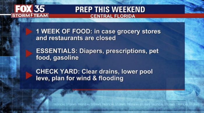
News sources are also sharing that those in Central Florida should take some time to make storm preparations.
UPDATE as of September 25th at 8AM: Overnight, the storm has shifted back to the east just a bit. You can see the shift in the video below.
Most of yesterday the models trended west but since late last night they have edged back eastward. Here’s a look at the trends! We all remain in the cone with impacts to be felt here Wednesday/Thursday. Stay with @WESH for updates. pic.twitter.com/AdTg2zBzKv
— Tony Mainolfi (@TMainolfiWESH) September 25, 2022
Here is a look at the 11AM update for September 25th.
Now, here is a look at the 3PM model. We will be interested to see how the storm continues to shift. News outlets are stressing that this storm is very unpredictable so we will continue to keep our eye on its trajectory in the coming days. (For some reason the image below says Friday, but these were just released.)
And a look at the 5PM model for the day. As we have said, the storm has inched east a bit today in comparison to yesterday. At this time, a tropical storm watch has been issued for the Lower Florida Keys.
You can get an even better visual with the video below.
Here's at look at the models for #IanL. Still a good spread across the Easter Gulf of Mexico but the trend has inched eastward today with two camps setting up. We will get active weather Wednesday/Thursday either way. Stay with @WESH for updates. #weshwx pic.twitter.com/ZgERXBeEt6
— Tony Mainolfi (@TMainolfiWESH) September 25, 2022
UPDATE as of September 26th, 2022:Tropical Storm Ian strengthened into a Category 1 hurricane by 8AM on September 26th. Here’s a look at its current position. It’s expected to continue moving northwest, and it’s currently moving at a speed of 14 MPH. According to the Orlando Sentinel, experts expect Ian to make landfall just north of Tampa Bay by Wednesday or Thursday.
On September 26th, 2022, Disney World announced upcoming closures for select hotels along with the mini golf courses and Disney’s Typhoon Lagoon. They have also adjusted the dining and experience cancellation policies until further notice.
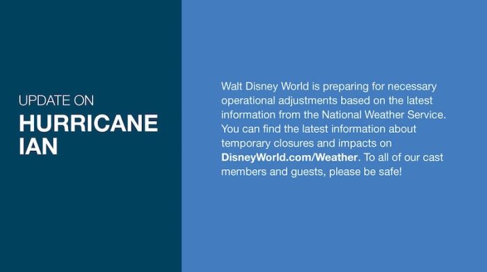
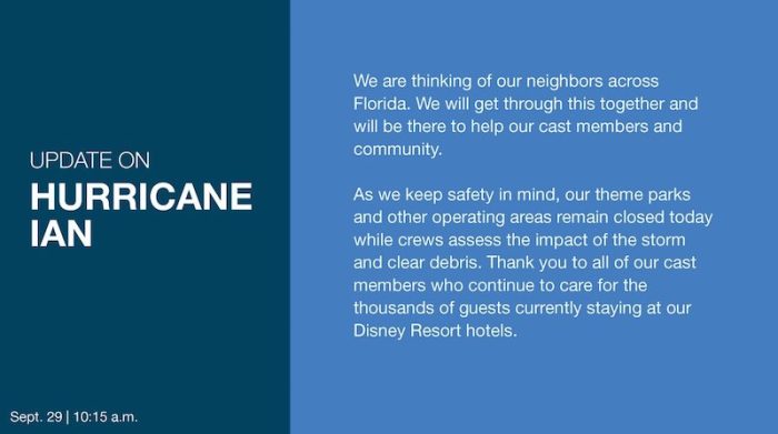
Disney has also made this statement on Twitter.
The Orlando Sentinel has reported that Hurricane Ian is continuing to gain strength and is moving on a path to target Florida’s Gulf Coast. There is also a threat to Central Florida, which is currently under a tropical storm watch.
An NHC hurricane specialist told the Sentinel that “Ian is expected to remain at or near major hurricane strength as it passes near the west-central coast of Florida on Wednesday and Thursday. An even greater concern is the slower forward motion that is forecast during this period, as the upper trough passes north and east of Ian and the steering currents weaken. This would likely prolong the storm surge, wind, and rainfall impacts along the affected portions of the west coast of Florida, although the roughly shore-parallel track still makes it difficult to pinpoint exactly what locations will experience the most severe impacts.”
On September 27th, 2022, the hurricane was upgraded to a category 3 hurricane.
Tropical Storm WARNING and hurricane watch have been also put in place for Orange County, Florida, and Osceola County, Florida. Those are the two counties that Disney World is located within.
BREAKING NEWS: Disney World, Universal Orlando, SeaWorld, and more local theme parks have announced multi-day closures ahead of Hurricane Ian. Airports in the Orlando area are closing as well. Disney World will close its theme parks and water parks on Wednesday, September 28th, and Thursday, September 29th. Disney Springs will be closed on Wednesday, September 28th. They expect Disney Springs will also be closed on Thursday, September 29th, but more updates on that will be coming soon.
Get all the details on the Disney World closure HERE!
On September 28th, the storm increased to a category 4 hurricane with winds expected to hit upwards of 155MPH.
The NOAA has also released what can be expected of the hurricane today and in the days to follow.
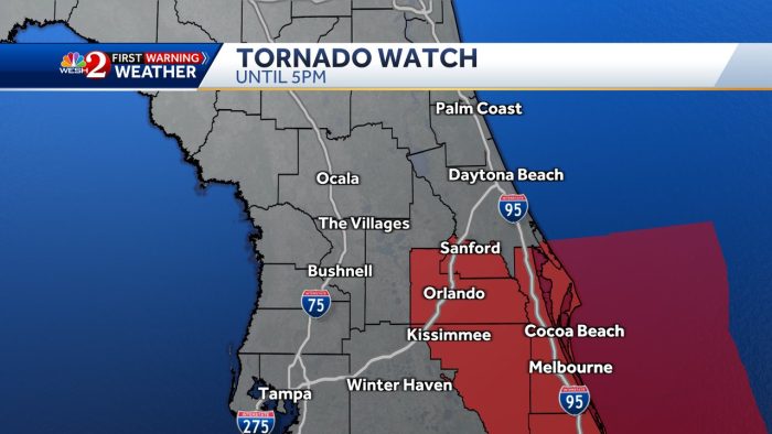
On top of this, a Tornado Watch has been issued for Central Florida. Later in the day a Tornado Warning was issued for Osceola and Brevard counties.
Hurricane Ian made landfall in Cayo Costa, Florida with winds of 150 mph — making it officially landing as a Category 4 storm at 3:05PM ET.
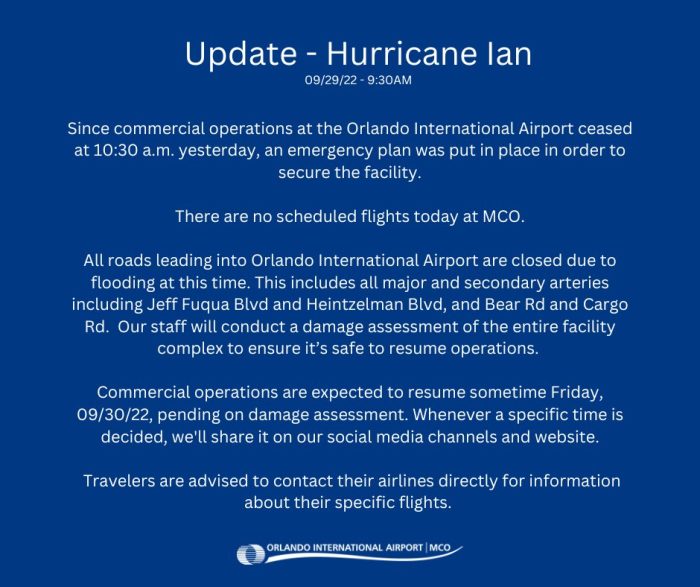
On September 29th, Hurricane Ian was downgraded to a tropical storm and significant flooding has taken place around Disney World and Orlando. Due to this flooding, the Orlando International Airport will remain closed today. You can read their most recent statement below.
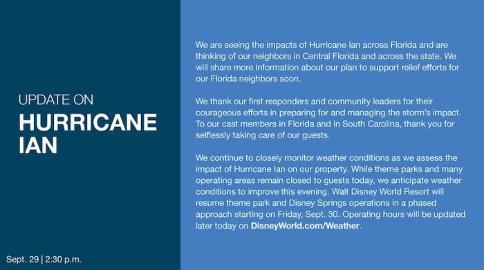
Disney has also released a statement. We have shared the park pass reservations are not available for tomorrow but as of now, Disney has only announced that they will remain closed through September 29th.
BIG UPDATE: Disney World will officially begin a phased reopening on Friday, September 30th.
If you’re visiting, make sure to come prepared with ponchos or other rain gear, and keep an eye on the weather forecasts during your visit!
Click Here to See the List of Disney World Rides That Close With Thunderstorms!
Join the DFB Newsletter to get all the breaking news right in your inbox! Click here to Subscribe!
WE KNOW DISNEY.
YOU CAN, TOO.

Oh boy, planning a Disney trip can be quite the adventure, and we totally get it! But fear not, dear friends, we compiled EVERYTHING you need (and the things to avoid!) to plan the ULTIMATE Disney vacation.
Whether you're a rookie or a seasoned pro, our insider tips and tricks will have you exploring the parks like never before. So come along with us, and get planning your most magical vacation ever!
Have you ever traveled to Florida during hurricane season? Tell us in the comments!






 Our handy (and portable!) ebook guides make sure you get the best deals and can plan a vacation of a lifetime.

TRENDING NOW
Flights are getting delayed today!
Get that last-minute holiday shopping done now!
A brand-new Stanley collection has just landed at Target!
We asked our readers what they'd like Disney World hotels to change and this was...
Now is a great time to grab those last-minute gifts from Amazon since some really...
Shrinkflation strikes again.
This special Magic Kingdom parade is changing tomorrow and we have all the details.
This Disneyland attraction will close soon for refurbishment.
There's nothing like riding on the Skyliner when you're at Disney World, and if you're...
Buckle up! Hollywood Studios is changing in the new year!
We've broken down all of the ins-and-outs of cruising Concierge level to help you know...
The owners of Gideon's Bakehouse are opening a new concept in Orlando and we've got...
A lot is changing in 2025, and if you're visiting in January, here's why you...
Disney's new timeline gives us a better idea when this EPCOT icon will be up-and-running...
A SPECIAL nighttime show is happening in Animal Kingdom right now!
We found bugs on the new Disney Cruise ship, but turns out it was a...
A NEW Disney movie is dropping in theaters and that means we're getting new snacks...
Disney just announced that a NEW hotel will be opening in Disney World in 2027!
Don't fall victim to these Disney packing trends! Pack these items instead!
There are a couple of dates that you need to avoid at all costs when...